
– In loco veritas –
In place there is truth
World Wine Regions is an interactive wine atlas – from wine lovers for wine lovers.
about
who the map is for
tell your wine story
map features
explore the map
custom mapping
FAQ
contact
about vW Maps
While we perfect some regions that are not yet drawn on the map, explore our atlas and imagine the possibilities of a customized version for your business.
Wine lovers can discover and explore their favorite wine appellation, its terrain, and any map information you’d like to add.
Whether you are a wine writer, publisher, national or regional winemaking association, or a marketer promoting wine regions and growers, telling a compelling story is an important part of your business. We can set you up with a customized, interactive wine atlas which makes your website more powerful and your region more memorable. Your readers and website visitors can compare topography and climate and research the appellations in your geographic area. The World Wine Regions atlas provides context and enables interactive storytelling, leading to a much higher reader engagement compared to stories with static images.
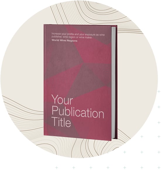
The WWR map will enhance any wine book, wine atlas, wine article or wine review. Indulge your readers with an immersive and interactive complement to your print publication. Wine enthusiasts can explore the terroir and zoom in on aerial photographs of individual vineyards and estates. Talk to us about a customized version of the map to accompany your print publication or embellish your website.

The WWR map adds a unique interactive experience to the websites of:
The World Wine Regions map:

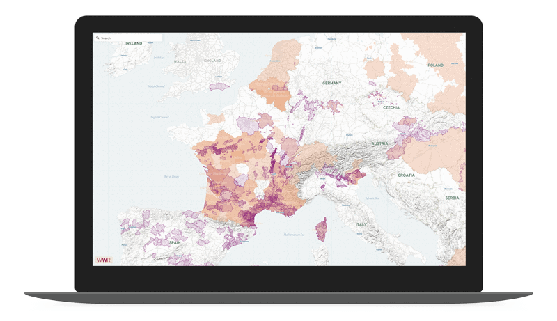
The atlas interface features a super-fast zoom from the global to the vineyard scale, plan view and oblique view. North does not have to be up and the area displayed can be constrained to your region. The atlas supports a full range of characters and diacritical marks.
The map is based on 2500 appellations including young, lesser-known wine regions plus some unofficial wine regions. It displays topography and aerial photography, can include climate or economic data (or a combination of both), and allows for multiple layers of wine region hierarchy.
We can add your growers and wineries and other data unique to your wine region. If it can be mapped, it can be added, from production quantities to historic maps to soil and geology information. We can even stylize the atlas to match your corporate identity.
Add your vineyards and wineries to the atlas and enhance your map with additional data.
Unique interactive map
Add tangible value and an immersive experience to any wine-related publication and website.
Fully customizable map
The map is customizable to suit your publication and your region. The atlas can be scaled down to be a map of just your region.
Add your own information
Your map can be enriched with local information such as vineyards, cellar doors, opening hours, phone numbers.
Monetize the map
Charge wine producers and estates in return for premium exposure on the map. Increase exposure of smaller or lesser-known wine regions.
Versatile use of the map
Present a map without region names as an interactive quiz. Users have fun testing and improving their knowledge.
Interactive storytelling
Increase engagement on your website. Provide a captivating experience for your readers and site visitors.
Customer exploration
Let wine lovers and your site visitors explore winemakers, growers, appellations, terroir, topography, climate and varieties of your region.
For wine tourists
Help wine enthusiasts plan their trip to your region to explore your growers and estates. The map’s user-friendly interface & search function allow wine lovers to go straight to their place of interest.
Increase your professional profile
If you are an industry expert, a wine writer, publisher or marketer, a customized version of the atlas adds to your exposure and your profile as a wine authority.
Our mapping platform allows endless customization. We can focus the atlas on only the information or area you want to present, use a background that suits your needs, and incorporate the design specifications important to your brand.
This depends on how large an area you need mapped, the level of customization, the amount of traffic you expect on the page, and so on. Talk to us for a comprehensive quotation!
Yes, the atlas is built with open source mapping tools and is fully compatible with all web and app platforms.
We’ll customize the map for you and give you the code in the form you need.
Start with us and we’ll let you know if you should be asking your website designer or host.

How can we help you?
We are a leader in the area of interactive maps and data mapping. Our client list includes National Geographic Partners, Penguin Group, Wine Australia, Australian Geographic, Massachusetts Institute of Technology, National Geographic Society.